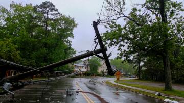
It is still bringing tropical storm force winds, rain and storm surge to Texas.
July 26, 2020, 11:43 AM
4 min read
Share to FacebookShare to TwitterEmail this articleHanna has weakened to a tropical storm as it continues to move inland this morning though it is still bringing tropical storm force winds, rain and storm surge to southern Texas.
The center of Hanna should be passing into Mexico right around this morning, however, Texans will still be contending with the wind and rain into this afternoon.
Rain will continue to move onshore as the center of Hanna moves slowly to the west-southwest.
The center of Hanna should be passing into Mexico right around this morning, however, Texans will still be contending with the wind and rain into this afternoon.
The center of Hanna should be passing into Mexico right around this morning, however, Texans will still be contending with the wind and rain into this afternoon. ABC NewsImpacts are still ongoing with a Tropical Storm Warning in effect as well as Flash Flood watches stretching from just south of Houston to Brownsville.
Even while the center is in Mexico, rain showers will be ongoing. Shower activity becomes more sporadic in the afternoon and evening hours and the winds will begin to calm down as well.
Elsewhere, Tropical Storm Warnings and Hurricane Warnings are up for the Hawaiian Islands as Hurricane Douglas makes its approach.
Hurricane Douglas is a Category 1 storm with sustained winds at 90 mph. It is currently 240 miles east of Kahului, Hawaii, and is moving west-northwest at 16 mph.
Douglas will be impacting the Hawaiian Islands today and tomorrow with wind, rain and rough surf. There is also a threat for flash flooding and landslides due to heavy rain forecasted.
Douglas will be impacting the Hawaiian Islands today and tomorrow with wind, rain and rough surf. There is also a threat for flash flooding and landslides due to heavy rain forecasted.
Douglas will be impacting the Hawaiian Islands today and tomorrow with wind, rain and rough surf. There is also a threat for flash flooding and landslides due to heavy rain forecasted. ABC NewsDouglas is forecast to weaken to a tropical storm overnight tonight into early Monday morning as it passes close to Kauai.
Douglas will also likely be making a close pass, not a direct hit, so no official “landfall” is expected though impacts will still be felt in the Hawaiian Islands.
Another broad area of low pressure is beginning to get its act together off the coast of Africa this morning as it moves westward. The National Hurricane Center gives it a 90% chance of development in the next 5 days.
Meanwhile, another Heat Wave is forecast for the Northeast this week.
Temperatures will be in the 90s through the middle of the week which should mean another official “Heat Wave” -- three consecutive days at or above 90 degrees -- is in the forecast for New York City and Philadelphia.
Temperatures will be in the 90s through the middle of the week which should mean another official “Heat Wave” -- three consecutive days at or above 90 degrees -- is in the forecast for New York City and Philadelphia.
Temperatures will be in the 90s through the middle of the week which should mean another official “Heat Wave” -- three consecutive days at or above 90 degrees -- is in the forecast for New York City and Philadelphia. ABC News


