
Many states will see record low temperatures.
February 13, 2021, 11:30 AM
• 6 min read
Share to FacebookShare to TwitterEmail this articleThe major winter blast occurring across the United States is about to get much worse.
Nearly every part of the U.S. is going to seeing dangerous weather over the next week.
At least 40 states have weather alerts Saturday morning, as multiple storms are moving from coast to coast and a dangerous arctic air is about to hit the Gulf Coast.
A major winter storm is brining heavy snow and freezing rain to the Pacific Northwest, including the cities of Portland, Oregon, and Seattle, Washington. Over 0.8 inch of ice has been reported in some places just south of Portland and 2 to 3 inches of snow have already fallen in both Portland and Seattle, with more expected to come.
Over 200,000 customers are currently without power in Oregon because of the ice.
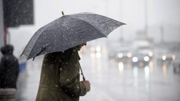
A person crosses the street during a snow storm on Feb. 7, 2021, in New York City.
The East Coast is experiencing a major storm with freezing rain, sleet and snow. Of particular concern is the significant ice (over a quarter of an inch) expected in Virginia. That's enough to cause downed power lines and trees.
The snow and ice will spread into parts of the Northeast Saturday from Washington, D.C., to New York. This will likely cause roads to be slippery and dangerous.
The major winter blast occurring across the United States is about to get much worse, Feb. 13, 2021.
On Sunday, the major storm from the West will dig into the Southern Plains with heavy snow expected from Colorado to North Texas. Significant snow is expected in Oklahoma. This will make travel very difficult.
Of even greater concern is the snow, freezing rain and sleet moving into Texas. Heavy snow will make travel nearly impossible around Dallas Sunday and Early Monday.
Also by Monday morning, a heavy wintry mix will move across Houston into Louisiana and Mississippi. Travel will be very dangerous as ice accumulates in the region.
Ahead of this storm, more snow and wintry mix will form across parts of the Midwest and the Appalachians. By Tuesday, the storm will have spread into the Northeast. Areas near the major cities may see freezing rain on Monday and Tuesday.
The major winter blast occurring across the United States is about to get much worse, Feb. 13, 2021.
This weather pattern will bring heavy snow from Seattle to Dallas and from Dallas to Maine. Additionally, and perhaps more dangerously, widespread ice accumulation is expected from Houston to New York City. Anywhere where there is ice, there is a risk of serious impacts to travel, power lines and trees.
Additionally, the arctic air will bring record low temperatures to the Central U.S. on Monday and Tuesday. Wind chills well below zero degrees will travel all the way into Texas. Houston will feel like -3 on Tuesday morning, which is very cold for the area.
The major winter blast occurring across the United States is about to get much worse, Feb. 13, 2021.
ABC’s Travis Herzog at KTRK is saying this cold weather could break records. The NWS in Dallas is calling the snow threat a historic winter storm. The NWS Weather Prediction Center is calling this a “once in a decade” event.
Overall, temperatures will be nearly 50 degrees below average in some parts of the U.S. through the first half of the upcoming week.
Parts of the Midwest have been suffering from the arctic air for over a week now. Chicago has not been above freezing since Feb. 4.