Rainfall totals could reach up to 4 inches, particularly in higher elevations.
April 5, 2020, 10:51 AM
4 min read
4 min read
Share to FacebookShare to TwitterEmail this article
An intensifying and complex storm system is bringing some bands of heavy rain and some mountain snow to parts of northern and central California this morning. This is only the beginning of significant mountain snow, heavy and flash flooding and gusty winds through much of California through Monday.
Winter Storm Warnings have been issued for a large chunk of California this morning. Some winter Storm Watches have been issued outside of Los Angeles and San Diego while Wind Alerts have been issued for parts of the region as well.
Winter Storm Warnings have been issued for a large chunk of California this morning. Some winter Storm Watches have been issued outside of Los Angeles and San Diego while Wind Alerts have been issued for parts of the region as well.
Winter Storm Warnings have been issued for a large chunk of California this morning. Some winter Storm Watches have been issued outside of Los Angeles and San Diego while Wind Alerts have been issued for parts of the region as well.ABC News
The most intense impacts from this storm system will occur Sunday and last well into Monday. On Sunday, the first wave of precipitation will push further inland and heavy rain and gusty winds will stretch down most of the California coast line, eventually reaching southern California Sunday evening.
The most intense impacts from this storm system will occur Sunday and last well into Monday. On Sunday, the first wave of precipitation will push further inland and heavy rain and gusty winds will stretch down most of the California coast line, eventually reaching southern California Sunday evening.
The most intense impacts from this storm system will occur Sunday and last well into Monday. On Sunday, the first wave of precipitation will push further inland and heavy rain and gusty winds will stretch down most of the California coast line, eventually reaching southern California Sunday evening.ABC News
The heaviest round of snow will arrive in the Sierras later Sunday. The heavy snow could cause very dangerous conditions on the roadways through the mountains.
Any essential travel could become extremely dangerous with white out conditions and road closures likely with winds gusts of up to 90 mph in the highest elevations of the Sierras.
As the rain reaches Los Angeles and San Diego, especially by Monday morning, locally heavy downpours and some thunderstorms will be possible where rainfall rates could reach 0.75 inches per hour.
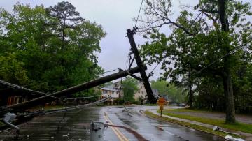
This could cause some flash flooding in urban areas with mud and debris flows and boulder slides. Winds at times could gust 45 to 60 mph which could down trees and power lines.
While part of this system will quickly move into the mountains, a lingering low pressure system will remain in the Southern California area and continue to spring up scattered rain and snow showers into the middle of the week.
Through the middle of the week, locally 1 to 4 feet of snow is possible in the Sierras. Snowfall will also be possible in the mountains outside of Las Vegas with locally over 1 foot of snow possible there.
It is important to note that ABC7 Bay Area Meteorologist Drew Tuma reported just a few days ago that the snowpack in California for the winter season was just 53% of average meaning additional snow is welcome news.
In parts of Southern California, rainfall totals could reach 4 inches, particularly in the higher elevations. Meanwhile, valleys and coastal areas could see over 2 inches of rain.
In parts of Southern California, rainfall totals could reach 4 inches, particularly in the higher elevations. Meanwhile, valleys and coastal areas could see over 2 inches of rain.ABC News
In parts of Southern California, rainfall totals could reach 4 inches, particularly in the higher elevations. Meanwhile, valleys and coastal areas could see over 2 inches of rain.
A disturbance will develop in the Midwest by Tuesday and bring some heavy rain and severe weather to parts of the region. Initial thoughts are that severe weather will be likely from Illinois to Ohio and northern Kentucky. Damaging Wind Gusts and large hail look to be the main concern for now.


