New tropical storm watches are in effect for parts of the Florida panhandle.
September 12, 2020, 10:49 AM
• 5 min read
Tropical Depression 19 is moving across the southern end of the Florida Peninsula Saturday. The center of the storm is now 25 miles west, southwest of Miami, Florida, and is moving west at 9 MPH.
The depression currently has winds of 35 mph. Tropical Depression 19 is expected to become Tropical Storm Sally later Saturday.
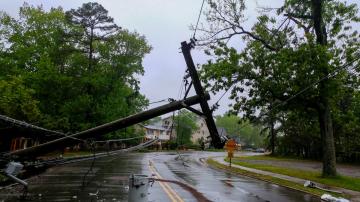
Flood watches have been issued for a large part of Florida Saturday morning. New tropical storm watches are in effect for parts of the Florida panhandle. Locally, heavy rain, which might fall in a quick time period, is expected to last through much of the weekend from Naples to Forty Myers to Tampa.
On its current forecast track, Tropical Depression 19 will likely be a strengthening tropical storm in the next few days as it heads towards the Gulf Coast. The current forecast track has the storm slowing down as it approaches the coastline beginning on Monday and lasting into the middle of the week.
Flood watches have been issued for a large part of Florida Saturday morning. New tropical storm watches are in effect for parts of the Florida panhandle.
Flood watches have been issued for a large part of Florida Saturday morning. New tropical storm watches are in effect for parts of the Florida panhandle.As with all hurricanes and tropical systems, the worst impacts are always on the right side of the storm. There is a window of opportunity over the coming days for the storm to strengthen, and a strengthening storm as it approaches land can be a tough forecast to nail down.
Ultimately, though, the immediate concern is a slow-moving storm that could bring a serious rainfall threat to the Gulf Coast in the coming week. It is too early to determine the magnitude of this rainfall event, but there is increasing confidence that rainfall totals could be excessive.
Elsewhere in the Atlantic basin, there are five additional systems worth watching.
One is a tropical wave drifting westward in the Gulf of Mexico. There is Tropical Storm Paulette, which will near Bermuda as Hurricane, possibly Category 2, by Monday. There is also Tropical Storm Rene, which will likely weaken to a tropical remnant low sometime this week.
The current forecast track has the storm slowing down as it approaches the coastline beginning on Monday and lasting into the middle of the week.
The current forecast track has the storm slowing down as it approaches the coastline beginning on Monday and lasting into the middle of the week.There is a tropical wave pushing well west of Africa traveling across the Atlantic, which has a 90% chance of formation in the coming days. There is also one more tropical wave just pushing off Africa that has a 50% chance of formation the next several days.
At this point, the primary concern to the United States remains Tropical Depression 19.
Meanwhile, air quality is expected to remain unhealthy across the western U.S. through much of the weekend as numerous large wildfires continue to burn across the region.
Satellite imagery actually shows a unique situation where a strong storm over the Pacific Ocean is essentially pulling smoke from the fires westward and trapping hazardous air in the major population centers. NASA is reporting that the smoke has traveled nearly 1,300 miles across the western U.S. and eastern Pacific Ocean.
Air quality is expected to remain unhealthy across the western U.S. through much of the weekend as numerous large wildfires continue to burn across the region.
Air quality is expected to remain unhealthy across the western U.S. through much of the weekend as numerous large wildfires continue to burn across the region.As that storm approaches, it will likely kick up some wind activity across parts of the west on Sunday and a red flag warning has been issued there. The good news is once that period of critical fire danger is over, wetter and cooler conditions next week should reduce the risk for fire spread and help clear out the dangerous air.


