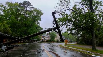
Isaias weakened late Saturday and is not expected back at hurricane strength.
August 2, 2020, 10:34 AM
5 min read
Share to FacebookShare to TwitterEmail this articleTropical Storm Isaias is currently bringing heavy rain and strong winds to parts of the Bahamas and Tropical Storm Conditions are nearing the east coast of Florida. The storm has winds of 65 mph and is about 45 miles east-northeast of Fort Lauderdale, Florida. The storm is moving northwest at 9 mph.
Isaias weakened late Saturday and has seemingly missed the opportunity to strengthen back to hurricane strength.
The storm is being affected by some wind shear and is expected to remain at Tropical Storm intensity over the next few days as it interacts with the East Coast of the U.S.
Because of this, all hurricane warnings in the U.S. have been dropped and converted to Tropical Storm Warnings. Tropical Storm Alerts now stretch from Florida to North Carolina and these alerts are likely to stretch northward through the day today.
Tropical Storm Isaias is currently bringing heavy rain and strong winds to parts of the Bahamas and Tropical Storm Conditions are nearing the east coast of Florida. The storm has winds of 65 mph and is about 45 Miles east-northeast of Fort Lauderdale, Florida. The storm is moving northwest at 9 mph.
Tropical Storm Isaias is currently bringing heavy rain and strong winds to parts of the Bahamas and Tropical Storm Conditions are nearing the east coast of Florida. The storm has winds of 65 mph and is about 45 Miles east-northeast of Fort Lauderdale, Florida. The storm is moving northwest at 9 mph.
ABC NewsThe current forecast track shows that the center of Isaias will move near or over the east coast of Florida today and into tonight. Isaias then will move back over the water passing by Georgia before moving into the Carolinas.
Then Isaias will pick up forward speed and accelerate into the Northeast U.S., likely tracking very close to I-95 from Washington, D.C. to Philadelphia to New York City and then moving into New England.
Isaias will pick up forward speed and accelerate into the Northeast U.S., likely tracking very close to I-95 from Washington, D.C. to Philadelphia to New York City and then moving into New England.
Isaias will pick up forward speed and accelerate into the Northeast U.S., likely tracking very close to I-95 from Washington, D.C. to Philadelphia to New York City and then moving into New England.
ABC NewsA careful look at the timing shows Isaias somewhere near Jacksonville or Daytona Beach by Monday Morning.
Isaias is expected to bring locally 6 inches of rain to parts of extreme eastern Florida and storm surge of 1 to 4 feet.
By Tuesday morning the storm is expected to be already inland likely moving north through North Carolina on its way to Virginia.
In the Carolinas and the Mid-Atlantic, the main threat emerging will be flooding due both to very heavy rain as well as coastal flooding.
By Tuesday evening, the storm will likely pass very close to New York City with torrential rain and some coastal flooding.
The emerging primary threat from Isaias will be the rainfall forecast.
There is concern of, locally, 4 to 6 inches of rain in a wide swath from the Carolinas to Virginia to New Jersey and New York.
The excessive rainfall could result in flash flooding, coastal flooding, and river flooding in the coming days.
The excessive rainfall could result in flash flooding, coastal flooding, and river flooding in the coming days.
The excessive rainfall could result in flash flooding, coastal flooding, and river flooding in the coming days.
ABC NewsOver 28 million Americans in the Northeast U.S. are at risk for severe weather today.
A warm front will lift north across Pennsylvania, New Jersey and New York this morning and this afternoon.
This will cause an initial round of storms for some this morning, especially along the New Jersey and Pennsylvania border.
As the region gets into the warm sector during the day, more storms will fire along and south of the warm front.
Later this afternoon and early evening, as a cold front nears the region, more storms could fire.
All storms, from Philadelphia, to New York, to Albany and to Watertown, could contain damaging winds, brief tornadoes and large hail.
Storms today could quickly drop over an inch of rain and cause flash flooding and all of this is in advance of rainfall impacts from Isaias.


