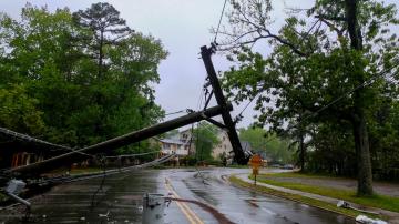
Sally is strengthening this morning and will continue to strengthen today.
September 13, 2020, 11:33 AM
• 4 min read
Tropical Storm Sally now has winds of 50 mph and is located 115 miles West of Port Charlotte, Florida, and 345 miles east-southeast of Louisiana as it continues to move west-northwest.
Sally is strengthening this morning and will continue to strengthen today.
Satellites show convection displaced from the center off to the south and east but the storm is likely to gain more symmetry over the next 24 to 48 hours.
Heavy rain continues to fall on the eastern side of Sally, especially from the Florida Keys to Sarasota.
Key West, Florida, recorded nearly 4 inches in just one hour overnight causing flash flooding there. Additionally, Key West, also observed 9.37 inches of rain yesterday.
Sally is expected to move northwest over the next 24 to 36 hours.
Unfortunately, Sally is expected to slow down as it approaches the Gulf Coast of the U.S. on Monday and Tuesday.
In this time period Sally will continue to strengthen. It is important to note that Sally is now forecast to make landfall somewhere in southeast Louisiana as a Category 2 Hurricane.
However, there is going to be a window of opportunity for rapid strengthening tomorrow and the chances for a stronger hurricane remain possible.
There is going to be a window of opportunity for rapid strengthening tomorrow and the chances for a stronger hurricane remain possible.
There is going to be a window of opportunity for rapid strengthening tomorrow and the chances for a stronger hurricane remain possible.Flood Watches have been issued for a large part of the Southeast U.S.
Regardless of the wind speed of Sally, the primary and most major concern remains the water because Sally is expected to slow down dramatically as it approaches the coast line.
Sally’s outer bands should begin to reach the Gulf Coast tomorrow morning. As we move through time, it is evident that Sally does not make significant progress inland until Wednesday morning.
This likely allows for up to 48 hours of storm surge and rainfall which could be a very dangerous situation.
The rainfall forecast now calls for up to 20 inches along the Gulf Coast. As with all hurricanes, this rainfall will be realized east of the center and could cause major flash flooding.
The rainfall forecast now calls for up to 20 inches along the Gulf Coast. As with all hurricanes, this rainfall will be realized east of the center and could cause major flash flooding.The rainfall forecast now calls for up to 20 inches along the Gulf Coast. As with all hurricanes, this rainfall will be realized east of the center and could cause major flash flooding.
The storm surge forecast is now up to 11 feet, again east of the center. This is an extremely dangerous and life threatening storm surge.
Sally is just one of seven tropical systems in the Atlantic basin.
Sally is just one of seven tropical systems in the Atlantic basin.Sally is just one of seven tropical systems in the Atlantic basin.
Paulette became a Hurricane overnight and is the sixth Hurricane of the 2020 Atlantic season and will arrive in Bermuda Sunday night and Early Monday.
There are also two more tropical waves pushing off Africa as well as Tropical Depression 20.


