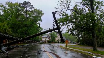
More than 2 million people are without power in the South.
October 29, 2020, 11:39 AM
• 4 min read
Zeta made landfall Wednesday in Cocodrie, Louisiana, which is just south of New Orleans, as the strongest storm to hit the U.S. this late in the season since 1899. It made landfall with sustained winds of 110 mph, making it a high end Category 2 storm.
This is the fifth named storm to hit Louisiana this year, which has never happened before.
The highest wind gust reported was 112 mph on Bayou Bienvenue, Louisiana, while the highest storm surge reached 8 feet in Waveland, Mississippi.
Zeta has now moved into northern Alabama and Georgia Thursday morning, about 65 miles northwest of Atlanta, with winds of 60 mph.
Zeta has moved into northern Alabama and Georgia Thursday morning, about 65 miles northwest of Atlanta with winds of 60 mph.
Zeta has moved into northern Alabama and Georgia Thursday morning, about 65 miles northwest of Atlanta with winds of 60 mph.As of 7:30 a.m. Thursday, more than 2 million customers are without power in four states. In Louisiana, 506,340 customers have no electricity, 277,488 in Mississippi, 283,568 in Alabama and 1,019,944 in Georgia.
There are at least two storm-related deaths in the South.
The storm has caused weather watches and warnings from Texas to New Hampshire Thursday.
The storm has caused weather watches and warnings from Texas to New Hampshire Thursday.
The storm has caused weather watches and warnings from Texas to New Hampshire Thursday.Some of the heavy rain and gusty winds from Zeta will move into the Northeast Thursday afternoon and evening, with flooding possible from Washington D.C. to southern New England.
Some of the worst flooding will be from D.C. to central New Jersey, but ponding on the roads is also possible in New York City and southern New England.
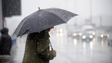
As cold air begins to interact with all the moisture, rain will begin to change to snow for northern New York and into northern New England Thursday evening.
As cold air begins to interact with all the moisture, rain will begin to change to snow for northern New York and into northern New England Thursday evening.
As cold air begins to interact with all the moisture, rain will begin to change to snow for northern New York and into northern New England Thursday evening.By Friday morning, the heaviest rain will be done, but whatever rain is left will be changing to snow very quickly from Pennsylvania into most of New York, Massachusetts and Connecticut.
Rainfall totals could reach 3 to even 4 inches from the Carolinas into the Northeast, where flooding will be possible.
Snowfall totals could reach up to 4 inches from upstate New York into Vermont, New Hampshire and higher elevations of western Massachusetts and northern Connecticut.
Snowfall totals could reach up to 4 inches from upstate New York into Vermont, New Hampshire and higher elevations of western Massachusetts and northern Connecticut.Snowfall totals could reach up to 4 inches from upstate New York into Vermont, New Hampshire and higher elevations of western Massachusetts and northern Connecticut. Some roads there could be icy as temperatures drop below freezing Friday night.


